Roller Coaster (200 Kilometer Brevet)

Date: 26 May 2018
Total distance: 202 Kilometers
Start Time: 5:30 am
Return
Time: 4:00 pm
With: -
Altitude
Profile:
Kanteerava Stadium -
Manchanabele - Magadi - Huliyurdurga - Kunigal - Hebbur - Nelamangala -
Kanteerava Stadium

A
new route was announced for the 200 kilometer brevet. I was keen on riding the
route since it had the added incentive of completing my second SR of the
2017-18 season. The route was passing through interior roads most of the time
and will be spending very little time on the highway. Can't ask for more than
to have a ride on countryside roads and having a good and peaceful ride on
Saturday.
Bangalore
had been receiving a lot of pre-monsoon showers and the day before the ride was
no different. It rained for most of the evening and the night. There were a lot
of messages circulating that a storm was expected on the day of the ride.
Queries regarding additional time in case of rains were struck down by the
organisers stating that there would be no additional time given in case of
rains making it clear that the ride had to be completed in 13.5 hours.
I
reached the start point at 5:15 am and completed the start formalities. It was
a huge turnout with 54 riders turning up for the ride. The start formalities
were completed smoothly and in spite of the large turnout the ride was flagged
off at 5:30 am.
The
ride through the city was negotiated with an eye on the traffic and the roads.
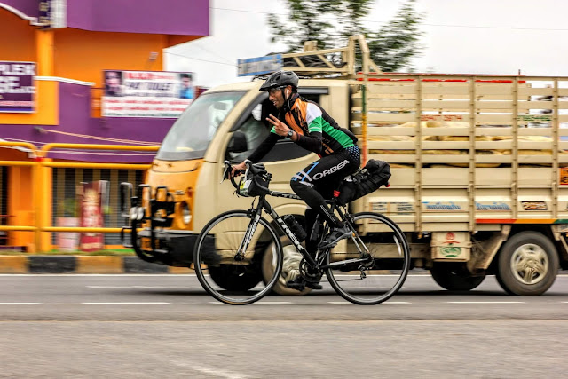
Riding the MTB did give me the luxury of going into the potholes aggressively
and I did not have to back off as much as the road bike riders. It allowed me
to carry speed and keep the momentum going which made it a little easy to keep
the pedals rolling.
45
minutes, 20 kilometers done and I had to take the right turn and get off the
highway. The ride starts here as we shift from riding on the highway to riding
on country side roads which we were told includes a lot of rolling terrain. It
was day break, however there was a lot of cloud cover and it was pleasant
weather. Damp roads, pleasant weather and the road surface was good as well,
perfect recipe to have an enjoyable ride.
The
first control point was at Magadi, however, before getting to Magadi we would
be passing through 3 beautiful locations which is on the radar of a cyclist in
Bangalore, Big Banyan Tree (Dodda Alada Mara), Manchanabele Dam and
Savanadurga.
The first of these on the route is Big Banyan Tree which
is just 8 kilometers from the highway. It is a 400 year old tree and it covers
an area of almost 3 acres. The road mainly climbs to this place and it took a
little effort to keep the cycle going. 20 minutes later we reached the Big
Banyan Tree. I stopped for a quick pic before resuming.

The road goes mainly downhill after
this. 8 kilometers from the Big Banyan Tree is the Manchanabele Dam. This is a
dam across the Arkavathy River and is a refreshing sight to sore eyes. As the
road is downhill I took the luxury of riding quickly so that I could catch a
few extra moments at the Dam. However, the additional speed did not allow me to
brake in time when the truck in front of me braked and brought me in the firing
line of an oncoming bus. Fortunately the bus driver was good enough to brake
and negotiated his way past me. I got away unscathed and continued riding. It
was a wake up call to be careful. It helped that the traffic thinned out after
this and I rode past the ISRO station set up to monitor the Mars Orbiter
Mission and made my way to Manchanabele Dam. It was refreshing to see the blue
water and I could not resist the temptation to stop for a pic.

The road continued further downhill
to Manchanabele village where we take a turn and enter the Savandurga forest.
The road begins to climb, however the effort is offset by the lush green forest
around us. It was beautiful and creepy at the same time to be riding this
stretch. The roads being in good condition helped a lot as it gave the
opportunity to enjoy the forest rather than concentrate on the road.


I was disappointed that I had
reached the main road to Magadi and I was out of the interior road. Within a
kilometer the mood changed again as I saw the cloud kissed Savandurga hill. It
is believed to be Asia's largest monolith and the view of the hill looked
majestic. There are various stories for the way the hill derived its name, one
of which is that it is the Fort of Death since getting to the top is very
dangerous as there were no steps to reach the hill top and it was covered by
bamboos and other trees forming a barricade making it almost impossible to get
to the top. The lake and the agricultural fields around added to the allure of
the place.


Although I was back on the state highway it did not
feel like it as I was still passing through the Savandurga forest. 3 kilometers
from the Savandurga hill I was out of the Savandurga forest, I was able to see
a peacock perched on top of a stone for having passed through the forest which
did not speak too highly of the forest in spite of the having erected boards of
leopards being the forest.
The
ride after crossing the forest till Magadi was not very enjoyable. It was like
going through a low phase after having gone through the high of seeing 3
beautiful places and having enjoyed riding through a forest road. The gradient
being uphill made it all the more difficult. I was counting down the kilometers
now rather than enjoying the view. A couple of checks on the map to check I was
on the correct route and I was at the first control point in Magadi town at
8:00 am. 56 kilometers completed and 2.5 hours had lapsed. I was not hungry and
as I had a supply of bananas I continued the ride rather than stopping for
breakfast.
The road continued to climb till I got to the turn to
Huliyurdurga. 28 kilometers to Huliyurdurga from here and it started with a
nice downhill section. I was back onto empty roads and rolling terrain
followed. I pushed hard in this section as it was mostly downhill and I could
create a buffer for the rest of the ride which was going to be rolling terrain
and largely climbing back to Bangalore. I passed through a few villages and saw
a couple of lakes on the way and then entered a forest area again. The tree
cover was good and it made riding a pleasure. There were large anthills to
accompany the trees and I sped through this section as it was largely downhill.
As soon as I was out of the forest area I could see the Hemagiri Hill of
Huliyurdurga. A few more kilometers and the Huthridurga hill which has Kempe
Gowda's fort atop was also visible which was the marker for Huliyurdurga. Just
a couple of kilometers and I was at the Kunigal highway and stopped at the
Inspection Bungalow which was the next control point.


I was
out of water and needed to re-stock. A kilometer from the control point I
stopped at a store to buy water and a 200ml sprite. I ate a banana and started
the ride. 88 kilometers were done and 4 hours had lapsed. I was 35 kilometers
from the manned control and had decided to ride to the manned control.
It
was only 35 kilometers to the control, however I was tired and had begun to
cramp. I had to minimise jogging on the wheels and was restricted to sitting on
the saddle and pedalling. There was a strong wind as well which had increased
the effort a little and I was not enjoying the ride here. The Sun had still not
made an appearance, however I was struggling to increase the pace of the ride. Add
the noise from the unlubricated chain to increase the irritation to it and it
was pretty painful to ride. I was able to take care of the chain at the next
town when I got to a bike mechanic who oiled the chain. One less thing to worry
about although it was very minor.
As I
got closer to Kunigal, it helped that there were downhill stretches and I was
able to recover a little and make up for the time lost as well. However, the
legs were still not feeling very good and it was just a matter of time before I
began to struggle again. I needed to rest for a while which I was not ready to
do. I tried massaging the legs while I coasted and kept sipping on water to be
able to push till the manned control.
I reached Kunigal at 10:30 am. 106 kilometers were done,
however, the next climb near the lake put me in a lot of pain as the cramp set
in and I was unable to recover. I stopped near the lake, left the cycle, walked
a little, stretched and admired the view by the lake. It was a huge lake. 5
minute break taken and I hopped back on the saddle to resume the ride.

I was 14 kilometers from the manned control and was
looking at a 45 minute ride to get there. It was largely an uphill gradient and
the legs did not like it at all. I had to stop again after 7 kilometers when
the cramps set in again. Followed the same routine of walking and stretching
before getting back on the saddle. Coaxed myself to get to the manned control
and I was there at 11:25 am. I was relieved to get there, since I knew that it
would serve up as a food and rest break.
Lokesh
welcomed me to the control. Raghu and Raju had already left, Sangram and
Abhishek were getting ready to leave and Kapil had just reached. I drank some
juice, ate the delicious veg pulav and a few chikki's as dessert. I stocked up
on banana's, refilled water and started from the control point at 11:45 am.
Kapil
and I rode together and we were back onto interior roads. We passed by mango
farms and it was very tempting to pluck a few mangoes and eat some farm fresh
mangoes. We rode on enjoying the view and the peaceful ride. There was almost
zero traffic and freshly laid tarmac which made the ride very enjoyable. A few
checks on the map and enquiries with the locals to stay on route. I was
beginning to struggle again and was just about managing to keep the cramps at
bay. I did not push hard on the climbs and kept it steady on the downhills
which helped to keep them away. The Bhairavadurga hill steals the show as we
close in on Kudur. Another huge monolith, which is difficult to miss.
From Kudur, we passed through a long section of road
lined by Banyan trees. These trees were planted and nurtured by Thimakka and
she is known as Saalu Marada Thimakka. Her efforts have borne fruit and it was
a pleasure to be riding in this section. The Sun was not out as yet, however
even if it was there was no way it was going to make it through the canopy of
banyan trees.


The road climbs from Kudur to Solur and it was slow
progress. We got fleeting glimpses of the Shiva Ganga hill on this stretch. The
thought of getting onto the highway was not very appealing as we would be back
on bald roads and having ridden through beautiful country roads since the
morning, it would be painful to ride on the highway without the scenery to back
it up. The clock had ticked passed 1:00 pm, however, I was still not hungry and
wanted to ride all the way to Bangalore. It was 1:35 pm when we got to the
control point at Solur, which took a little searching.
50
kilometers remained and although I had sufficient time, I wanted to ride as
quickly as possible to Bangalore. It started well as there were long downhills
and I was able to cover distance quickly, however at the first hint of a climb,
I fell behind Kapil. I was very slow, and not wanting to push too hard I took
it easy on the climb. I reached the Nelamangala toll and although I wanted to
continue, I had to stop since I was out of water. I doubled it up with a
sugarcane water break and had two glasses and hoped that I would be able to
sustain the ride till the finish. Kapil had stopped to rest and I resumed the
ride.
The
Sun was out when we got onto the highway and the intensity of the Sun began to
increase when I made it past Nelamangala. I was able to pedal quickly after the
water/juice break but the Sun was making it very difficult. As I was in
familiar territory, I was able to sustain the speed and kept pushing to make it
to Bangalore city. I made it to the Yelahanka flyover and was fortunate not to
cramp while climbing, the body had recovered a little on the easier terrain
from Solur and I pedalled into heavy traffic from Yeshwanthpur.
The
ride from Yeshwanthpur till Sankey tank was about wriggling my way past
traffic, however I was able to keep moving. From Sankey tank the traffic was
chock a block and I had to use the foot paths a lot to keep moving. The situation
did not improve and I was in a lot of traffic right till the end at Kanteerava
Stadium. It was just before 4:00 pm when I pulled up at Kanteerava stadium.
200 kilometers completed in 10.5 hours, was disappointed
with the time taken, however, was happy to have made it back in spite of the
cramp. Will have to rest and recover before analysing what went wrong on this
ride.


Comments
Post a Comment